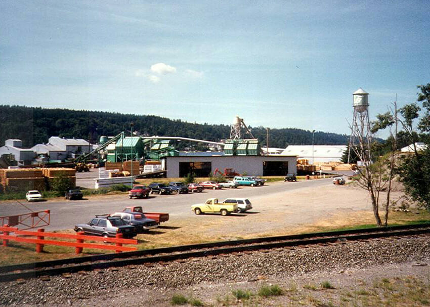
This EPA Superfund site in Renton was once home to a sawmill, coal tar refinery, and creosote plant. BRH provided a topographic map of the uplands and beach areas, as well as hydrographic mapping to identify below tide conditions. These surveys documented locations of creosote-laden logs, and other contaminated debris.
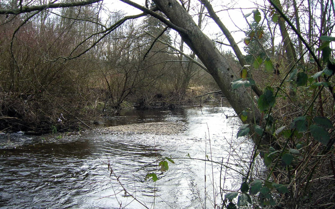
The creek was rehabilitated to stabilize the bank during flood conditions and restored to enhance the fish habitat environment. BRH provided a river bank profile survey and wetland delineation in order to support the design and environmental permitting team.
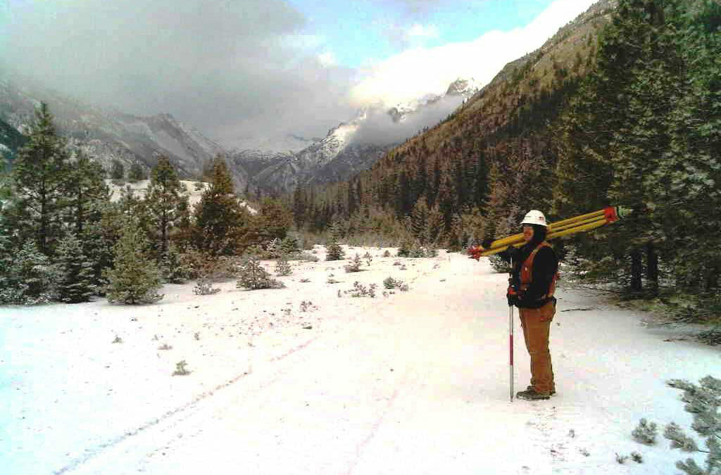
Railroad Creek, located 10 miles west of Lake Chelan, was remediated with oversight by USDA Forest Service, Federal EPA and the Washington State DOE. BRH services included land surveying to support forest clearing limits, staking, volumes and layout activities.
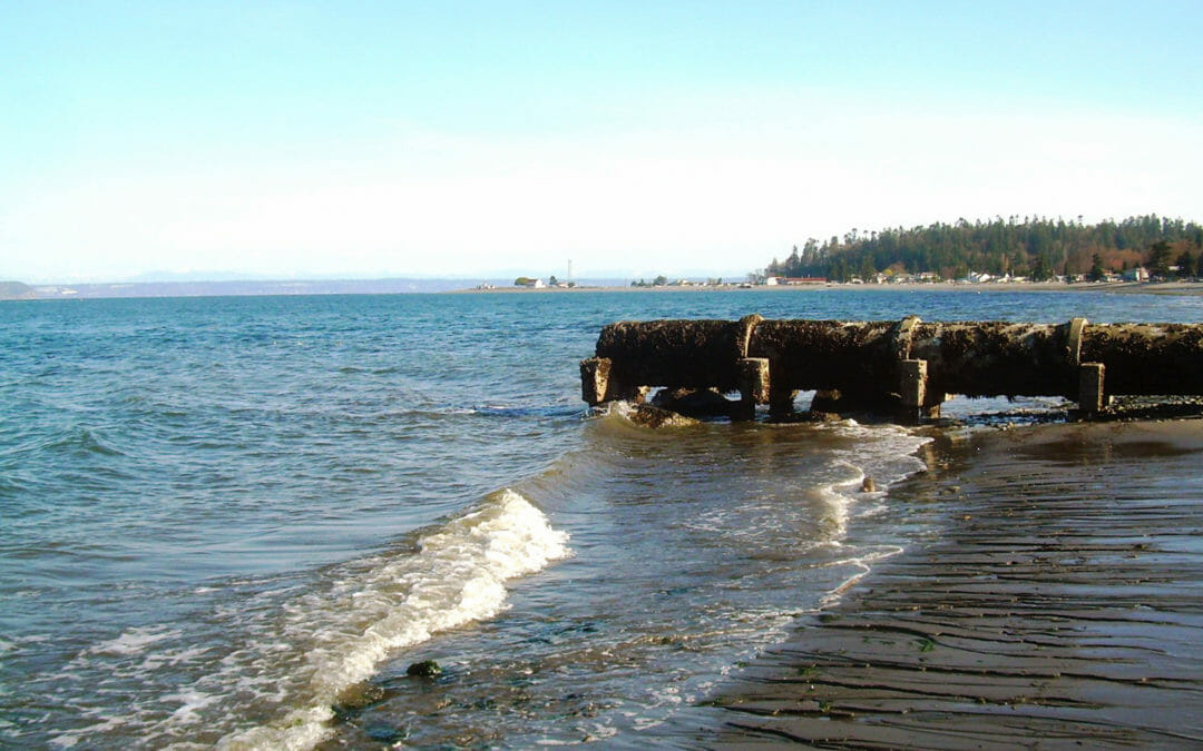
This Kitsap County site required restoration of the estuary. BRH provided a boundary and topographic survey of the site and adjacent areas, including a County park and the adjacent beach. We provided the elevation of the shoreline at mean sea level, as well as low and high tide levels, including a notation of the dates and times observed.
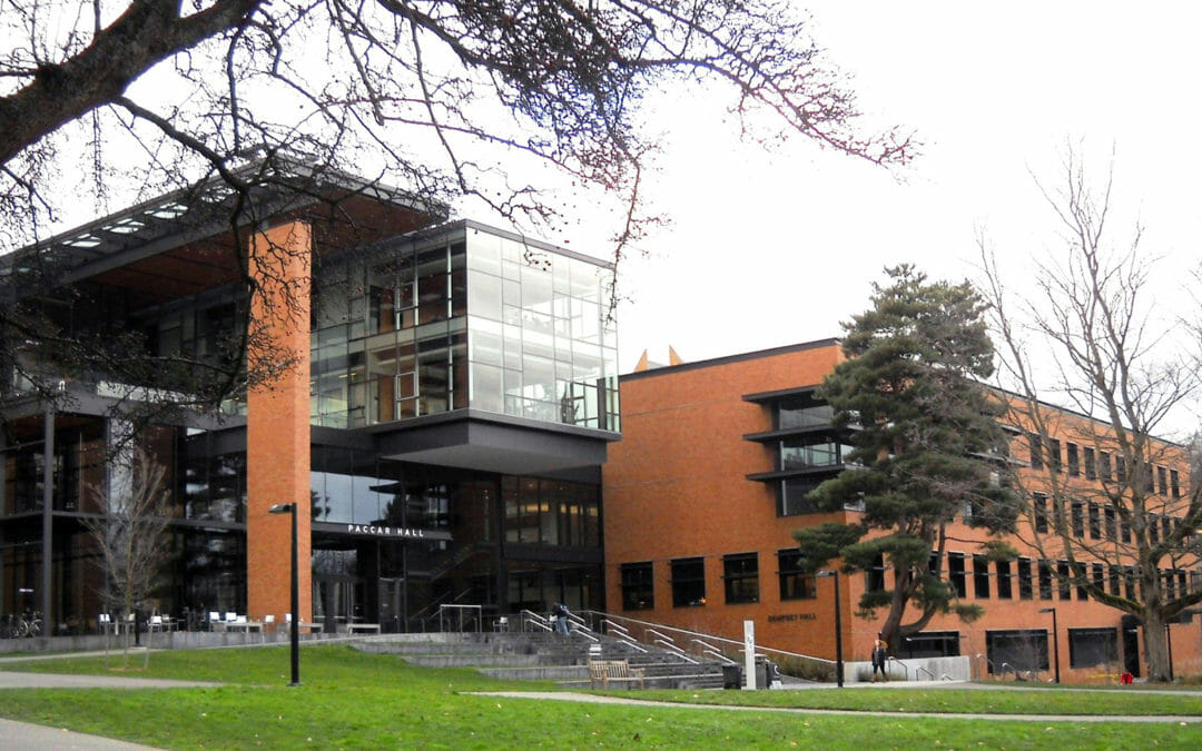
BRH provided a topographic base map showing all features such as buildings, retaining walls, adjacent roadways, paths, and underground utilities for Paccar and Dempsey Halls. Vaults were also shown, as were fiber-optic and secondary power lines, plus we provided a 3D “as-built” survey of the tunnel system.
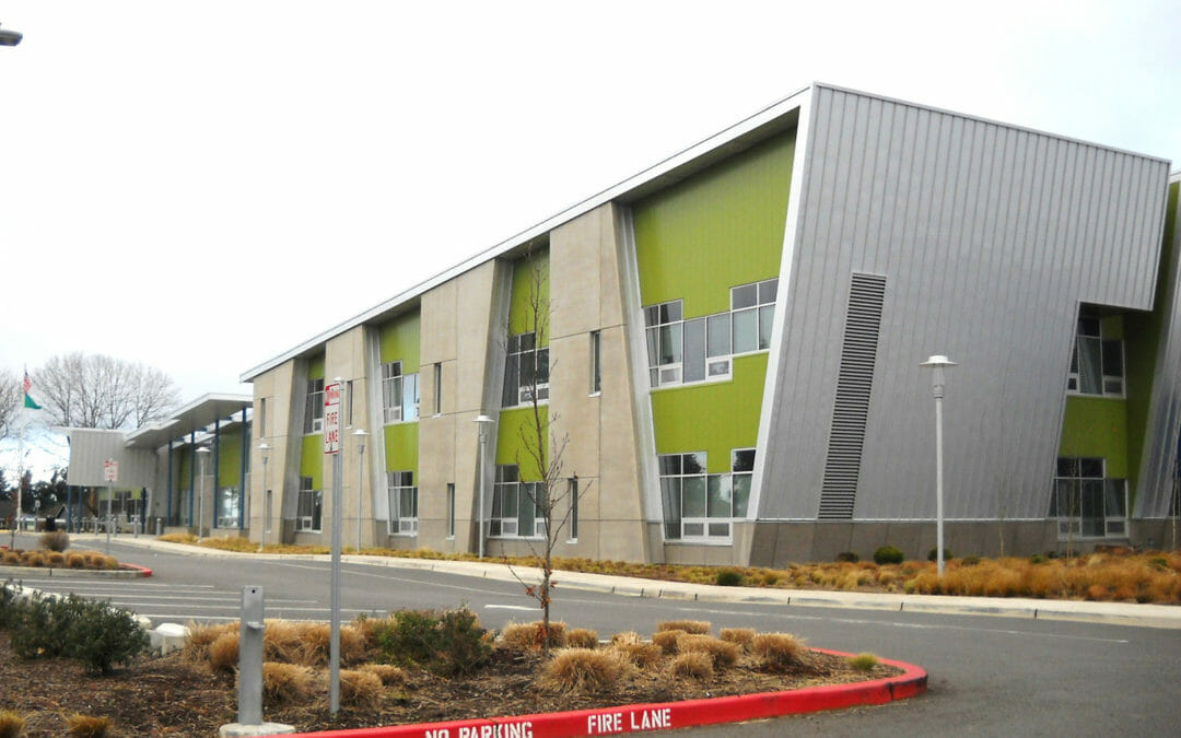
This new K-6 school is a 2-story, 66,500 square foot facility serving over 450 students. BRH was contracted to provide a full-site topographic and utility survey for this demolish and reconstruction project. The scope included the provision of spot elevations on a 50-foot grid to generate contours for the design team.
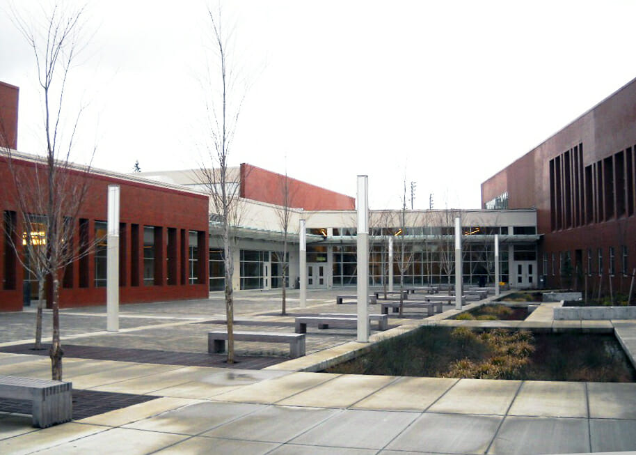
This 1,400 student school received a complete renovation and modernization, including a new performing arts center, gymnasium and classrooms. BRH provided a full boundary and topographic survey of the school grounds. Our mapping included detailed utility data over the entire school property for the engineering team.
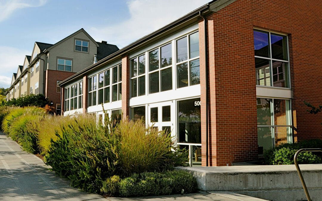
This 5 story residence houses 363 students in a full amenity facility. BRH has worked on multiple sites all over the Seattle Pacific University campus. For Emerson Hall, we provided topographic mapping and utility detection and location.
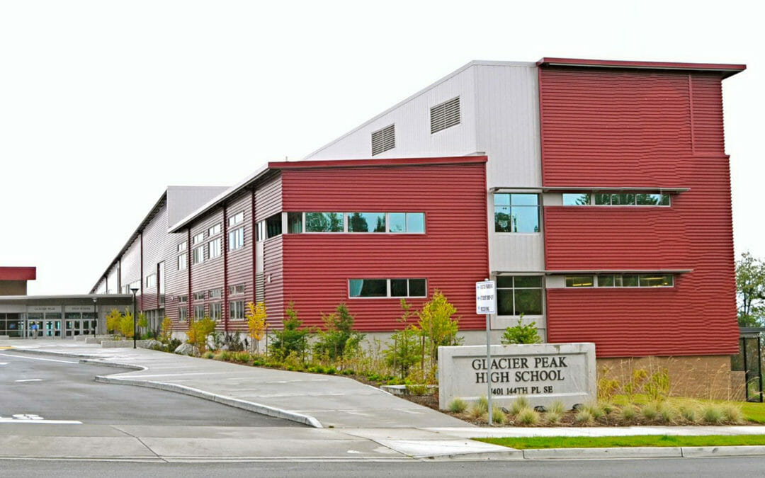
Glacier Peak High and Little Cedars Elementary share a 65-acre, Snohomish School District site. We conducted easement research and provided boundary, topographic and utility surveys on this heavily forested site. The scope included extensive right-of-way surveys along SR9 and Cathcart Way.